Trek-Tastic!
Get ready for the best-rated hikes in UK and Europe!
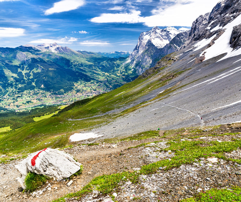
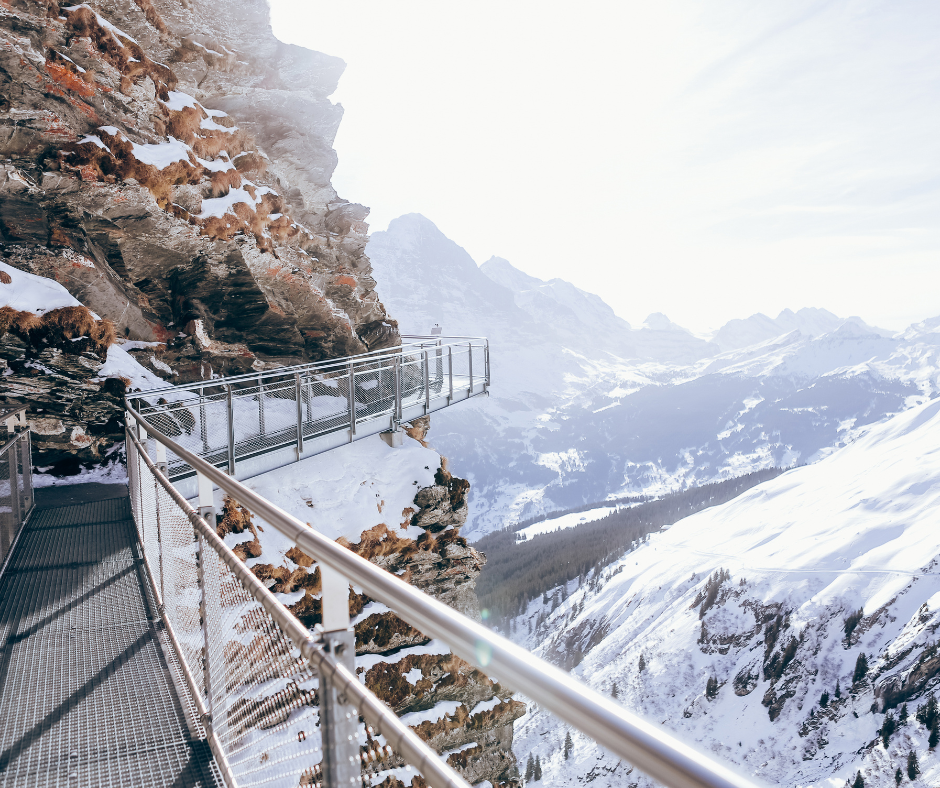
THE EIGER TRAIL
LOCATION: Jungfrau Region of Switzerland
Distance: 4.5 miles
The Eiger Trail follows the north face of the Eiger mountain, with astounding views across the Lauterbrunnen Valley to Mürren and Grindelwald.
You don’t have to be super fit to experience these once-in-a-lifetime views, either – and it’s perfect if you’re Xploring the area with kids.
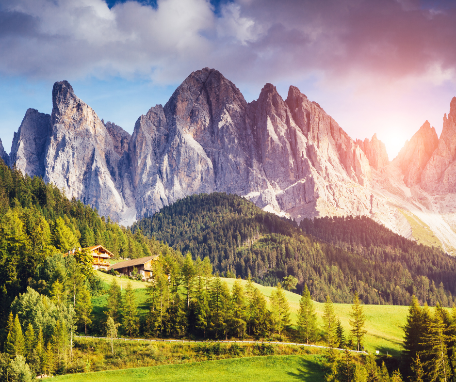
PUEZ-ODLE ALTOPIANO
LOCATION: Italy
Distance: 10-11 Miles.
This one’s rated one of the best hikes in Europe!
The Dolomites give hundreds of miles of crisscrossing trails, with epic views – especially popular with Summer hikers.
There is a long list of great hikes to do in the Dolomites, from short, easy trails to multi-day treks. Of the few trails that we hiked in the Dolomites, the Puez-Odle Altopiano was our favorite.
The Puez-Odle Altopiano trail runs along some of the highest peaks in the Dolomites. Take a chairlift at the start – a cheat, lopping 700m off your climb, but great fun – and enjoy the amazing views.
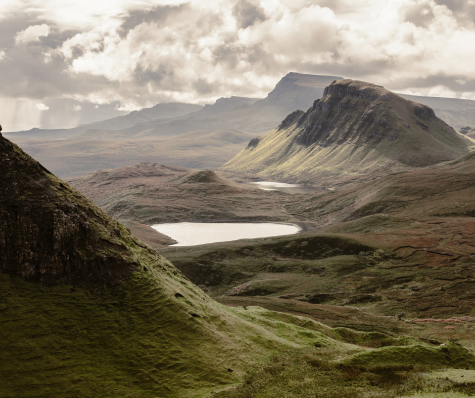
THE QUIRAING, ISLE OF SKYE
Distance: 4 miles.
Quiraing boasts bizarre but beautiful rock formations, luring geologists, photographers and tourists from around the World. But the best way to appreciate the Quiraing is to hike it.
Go it alone if experienced and competent, or join mountain guides to learn essential climbing skills in Skye’s spectacular Cuillin Mountains and tackle the renowned Inaccessible Pinnacle.
Whichever way you do it, you’ll never regret visiting this land of myths and legend.
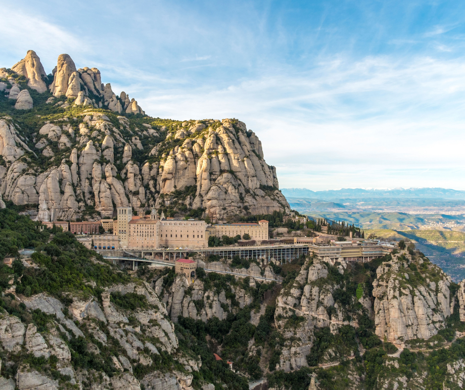
MONTSERRAT
LOCATION: Spain
Distance: 3 miles.
Montserrat is a rocky mountain range in Catalonia, Spain. “Montserrat” translates to “saw mountain” in Catalan, owing to this mountain range’s jagged, sawtooth appearance.
This hike can be done as a day trip from Barcelona, if you fancy switching up your trip. Take a train from the city, then a cable car or railway into the mountains - or hike the climb if you’re feeling energetic.
Aim for monastery for the best views along the trail.
MÜRREN VIA FERRATA
LOCATION: Jungfrau Region, Switzerland
Distance: 1.4 miles one-way.
Short in distance, but big on thrill-factor, Mürren is part ‘via ferrata’ and part hiking trail. You’ll need nerves of steel to master Mürren, with its cliffs, ladders, tightrope, suspension bridge and zip line across a ravine.
If you can do it, we salute you! Make sure you post your pics and #Xplore
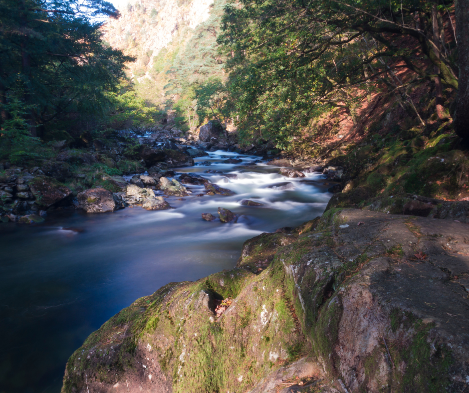
ABERGLASLYN GORGE AND CWM BYCHAN, SNOWDONIA
Distance: 6 miles.
This is a circular, six-mile route, starting and ending at the little footbridge at Beddgelert. It takes in some of Snowdonia’s most stunning scenery, from the calm waters of Llyn Dinas to the spectacular Aberglaslyn Gorge, with the Glaslyn River racing alongside you.
There are wild swim spots to be found along the way.
This hike will earn you views of Yr Aran, Lliwedd, Siabod and Snowdon (Yr Wyddfa) on your descent.
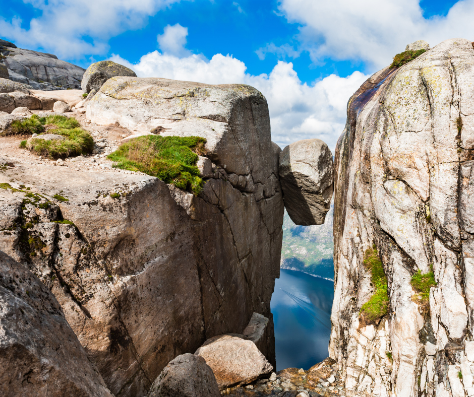
KJERAGBOLTEN
LOCATION: Norway
Distance: 7.5 miles.
You will have seen this giant boulder, wedged between two cliffs and perched 1000 meters off of the ground, on many an Insta account. If you fancy taking the mother of all hiking pics, head to Kjeragbolten.
Photo opportunities aside, this hike is rated as one of the best ever, with sheer granite faces, dramatic valley views – pure adrenaline, if you dare!
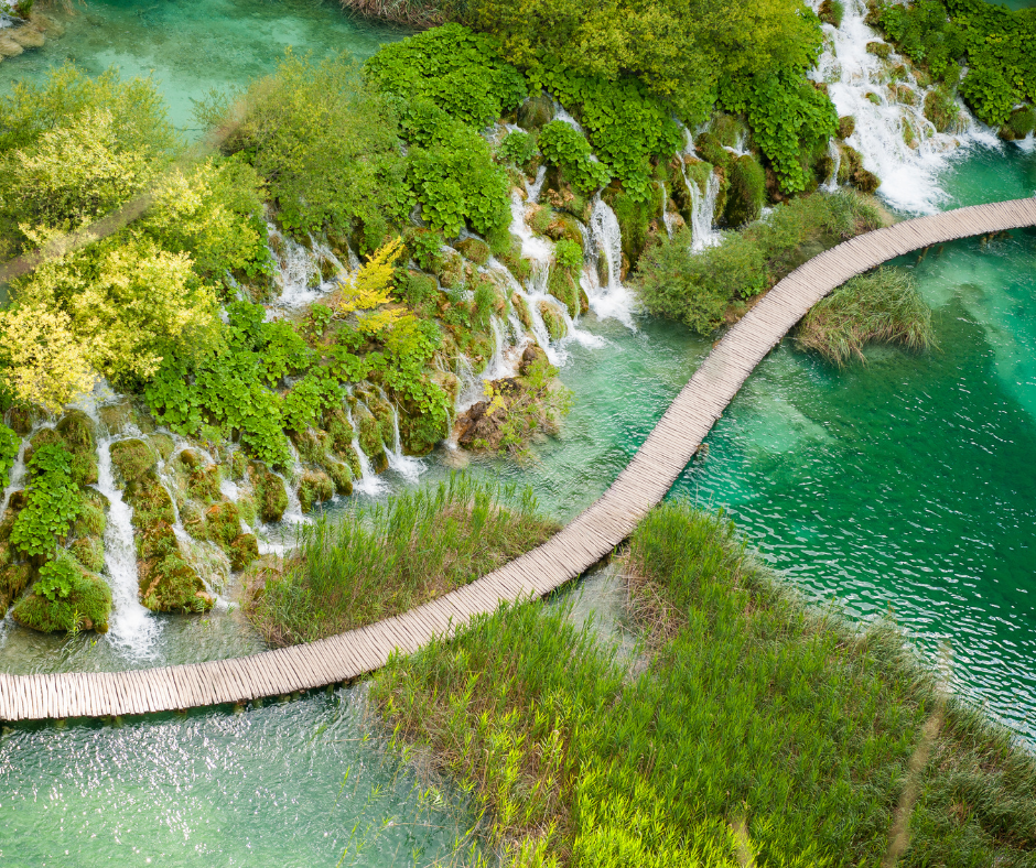
PLITVICE LAKES
LOCATION: Croatia
Distance: 5 – 7 miles.
Plitvice Lakes, in Croatia, is a perennial favourite with Xplorers of all ages. Plitvice has it all: boardwalk bridges over jewel-bright turquoise water, magical waterfalls and perfect views at every turn.
Parts of Plitvice are linked together with shuttle buses and boats, so you can tailor your trip to how much time you have.
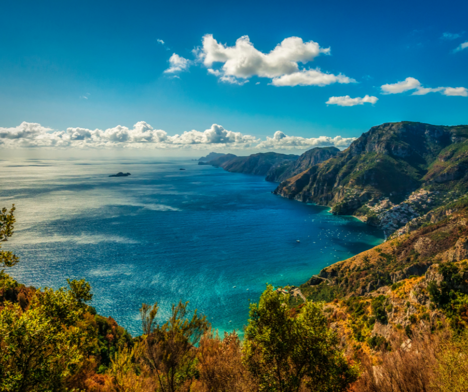
PATH OF THE GODS
LOCATION: Amalfi Coast, Italy
Distance: 3.5 miles
As the name suggests, this hike is rather heavenly! You’ll uncover the Path of the Gods (also called Sentiero degli Dei) perched above the coastal towns of Positano and Praiano is one of the most beautiful walks in Italy, the Path of the Gods (also called Sentiero degli Dei) on the Amalfi Coat, with awesome views of Positano and the Sorrento peninsula.
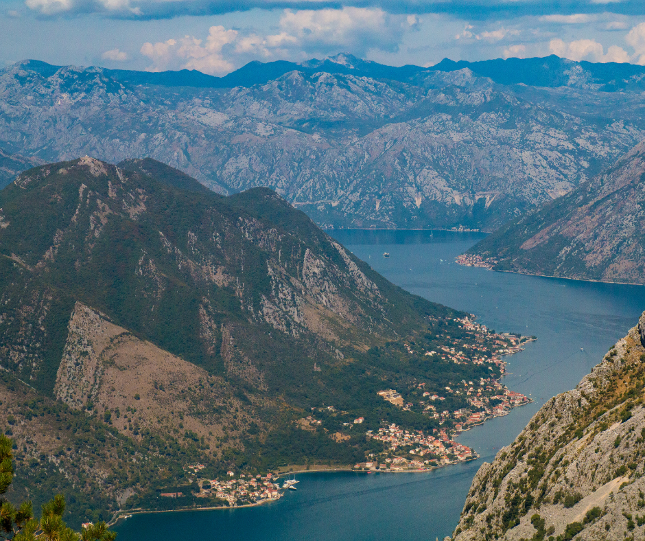
THE LADDER OF KOTOR
LOCATION: Montenegro
Distance: 4 miles one way / 8 miles round trip.
Montenegro’s Bay of Kotor should be on your bucket list. The views are one of a kind and, if you’re able to, time your hike to revel in sunset – an image that’ll be burned into your memory forever!
Start at the Old Town of Kotor and ascend from the get-go. This is strenuous, with as many as 70 switchbacks on the trail… But the higher you go, the better the view!
Below you stretches out the fjord-like terrain and a riot of colour.
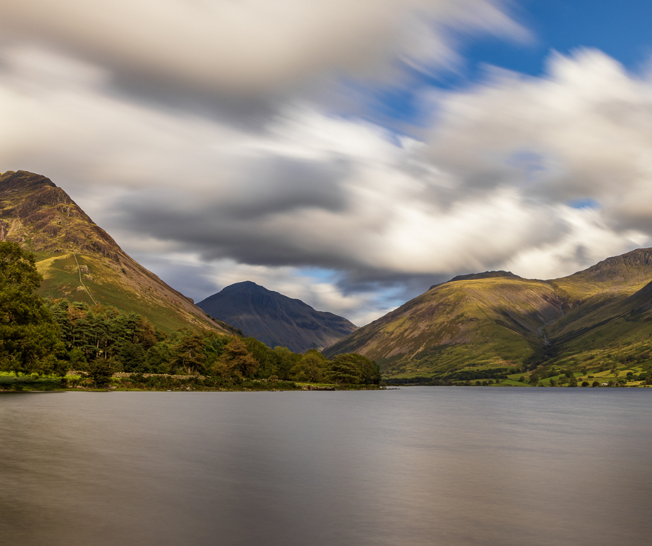
SCAFELL PIKE, LAKE DISTRICT
Distance: Various.
Scafell Pike is the tallest mountain in England and one of the best hikes in the UK.
There are several ways to reach Scafell Pike, the roof of England . There’s usually a crowd of walkers leaving Wasdale, in the western part of the Lake District, taking the shortest route to the top. But there’s a lesser-known way to reach the 977-metre-high summit…
Break free from the herd and start from the more scenic - and less crowded north side - beginning in Seathwaite (or Borrowdale for a longer hike). Known as the ‘Corridor Route’, this nine-mile trail follows the valley, crossing ravines before you reach Scafell Pike’s summit boulder field.
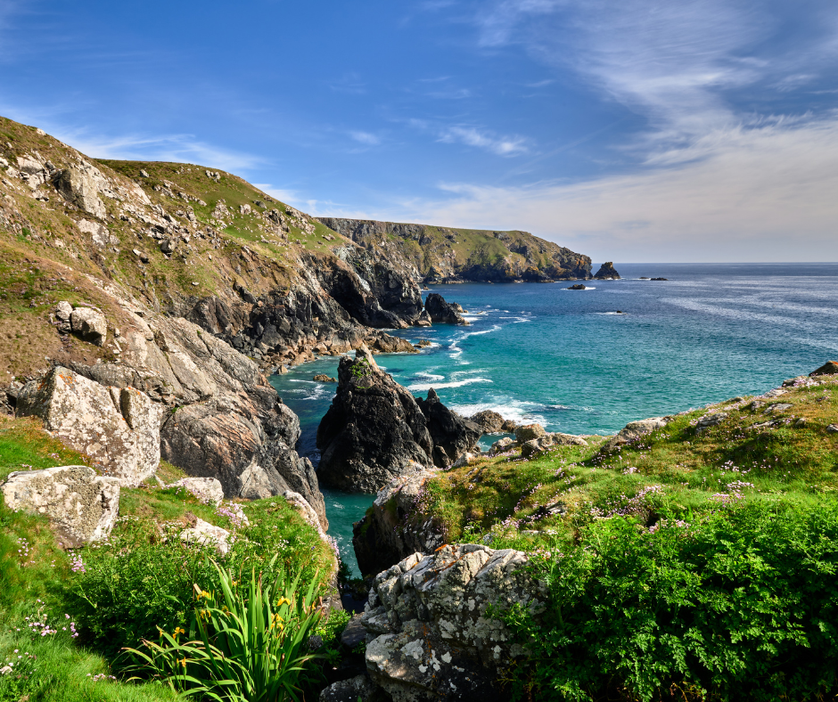
SOUTH WEST COAST PATH (THE LIZARD), CORNWALL
Distance: Various.
The South West Coast Path follows 630 miles of spectacular coastline, from Minehead in Somerset to Poole Harbour in Dorset.
The Cornish section of the trail is home to plenty of secluded beaches, for a refreshing dip or an impromptu picnic. Walk four miles around the rugged tip of The Lizard, the mainland’s most southerly point and watch for dolphins playing in the water below.
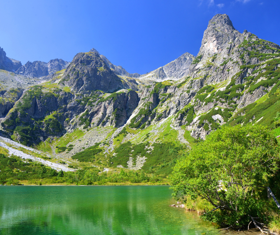
THE GREEN LAKE (ZELENE PLESO) & VEL’KÁ SVIŠT’OVKA
LOCATION: High Tatras, Slovakia
Distance: 8 miles.
The High Tatras are off the well-trodden tourist trail, but easily accessible – and boast great bragging rights. From the old-world grandeur of Zakopane in Poland to the sparkling emerald-green lakes and jagged peaks here in Slovakia, this region has everything going for it!
This particular stretch is for the more experienced, than some of the other local treks, but worth persevering for the views!
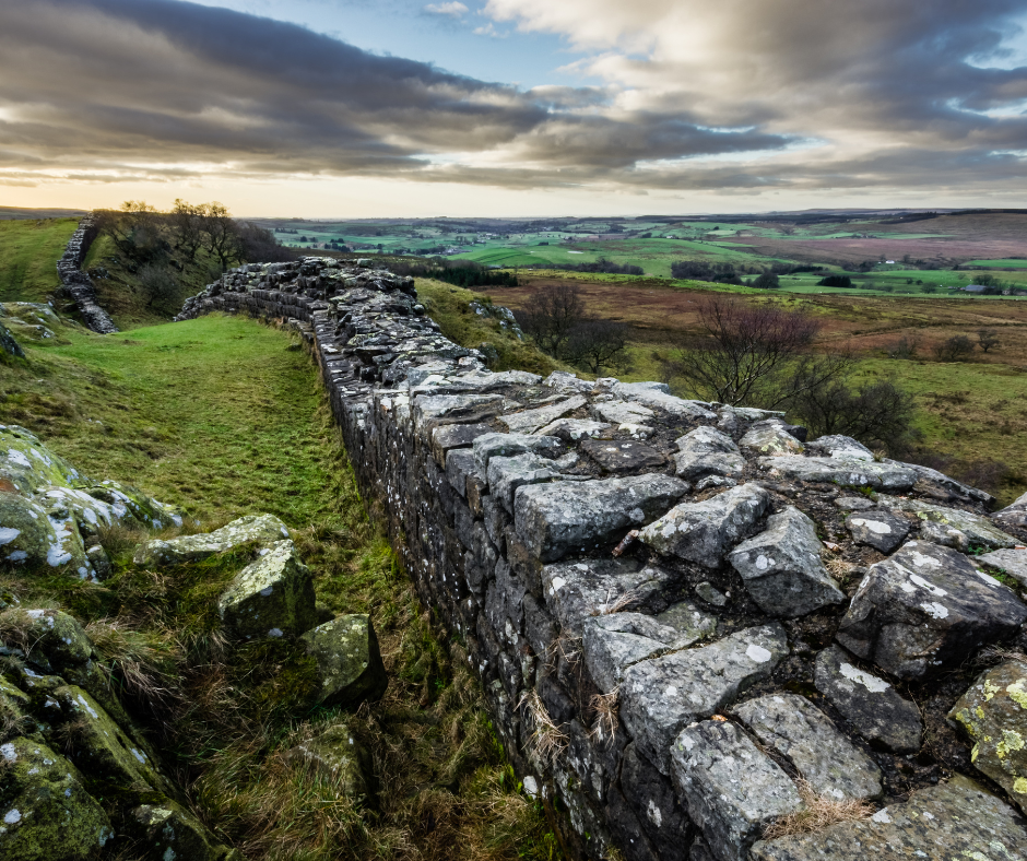
HADRIAN’S WALL PATH (CHOLLERFORD TO BIRDOSWALD FORT), NORTHUMBERLAND AND CUMBRIA
Distance: Various.
Built between AD 122 and 128, an almost 75 mile-long wall once formed a barricade defending the Romans from the Scottish Picts – and was named after the Roman emperor who ordered it to be built. Remnants of the wall remain, dotted with ancient settlements, forts and fascinating museums – now an UNESCO World Heritage site.
Some of the most popular sections are Steel Rigg to Housesteads, but for the more intrepid, the 20-mile stretch between Chollerford and Birdoswald Fort is the highest section of the Wall, with magnificent views of both the Lake District and the Pennines.
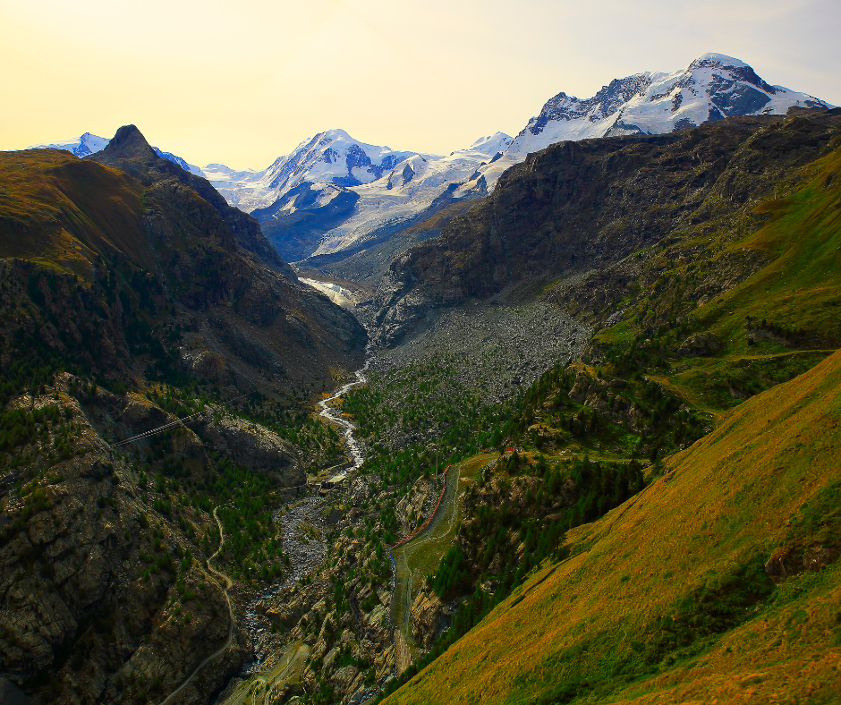
GORNERGRAT TO RIFFELSEE & RIFFELBERG
LOCATION: Zermatt, Switzerland
Distance: 3 miles.
For views of the iconic Matterhorn, this is the trail for you!
Gornergrat boasts the highest open-air railway in Europe. From Gornergrat, you’ll see the second largest glacier in the Alps (Gorner Glacier), Switzerland’s highest peak (Dufourspitze), and the Matterhorn itself.
Hiking from Gornergrat to Riffelberg is mainly downhill, so suitable for all ages and experience levels. Along the entire trail, the Matterhorn is right there in front of you, so the journey time will depend on how often you stop to take photographs!
You can end the hike at Riffelsee, or extend to Riffelberg. From Riffelberg, take the train back to Zermatt or go even higher, tagging on a visit to the Matterhorn Glacier Paradise.
Related Articles
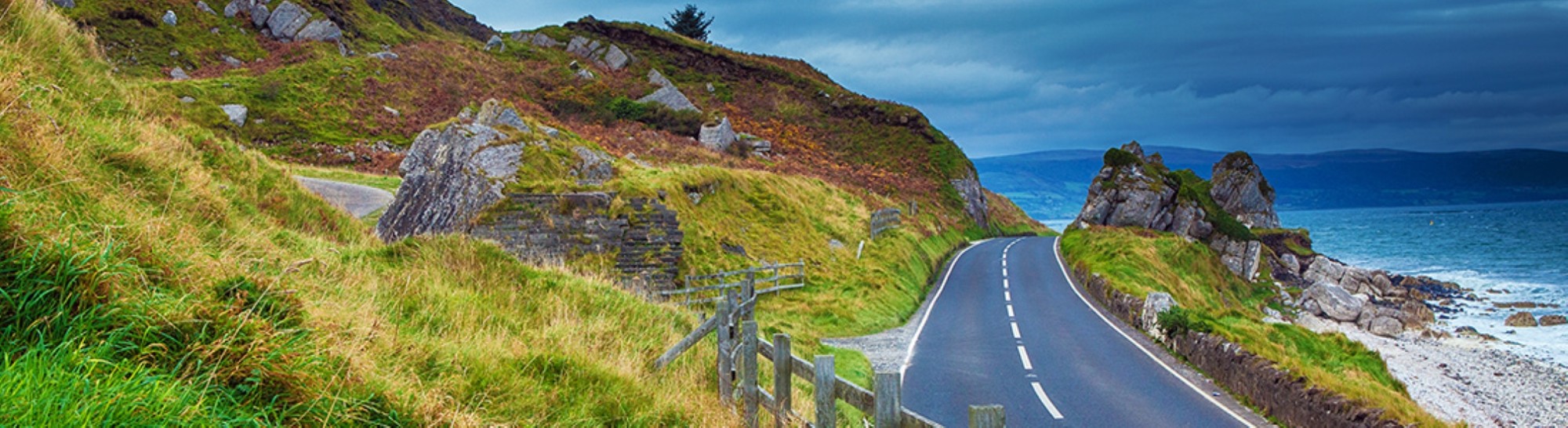
Coastal Causeway
The Causeway Coastal Route spans the stunning Atlantic coast from Londonderry/Derry to Belfast – or vice versa, depending on which direction you want to travel!
Trek-Tastic!
Get ready for the best-rated hikes in UK and Europe ... and Xplore the exceptional.